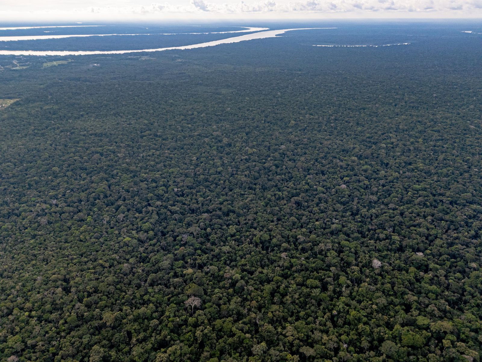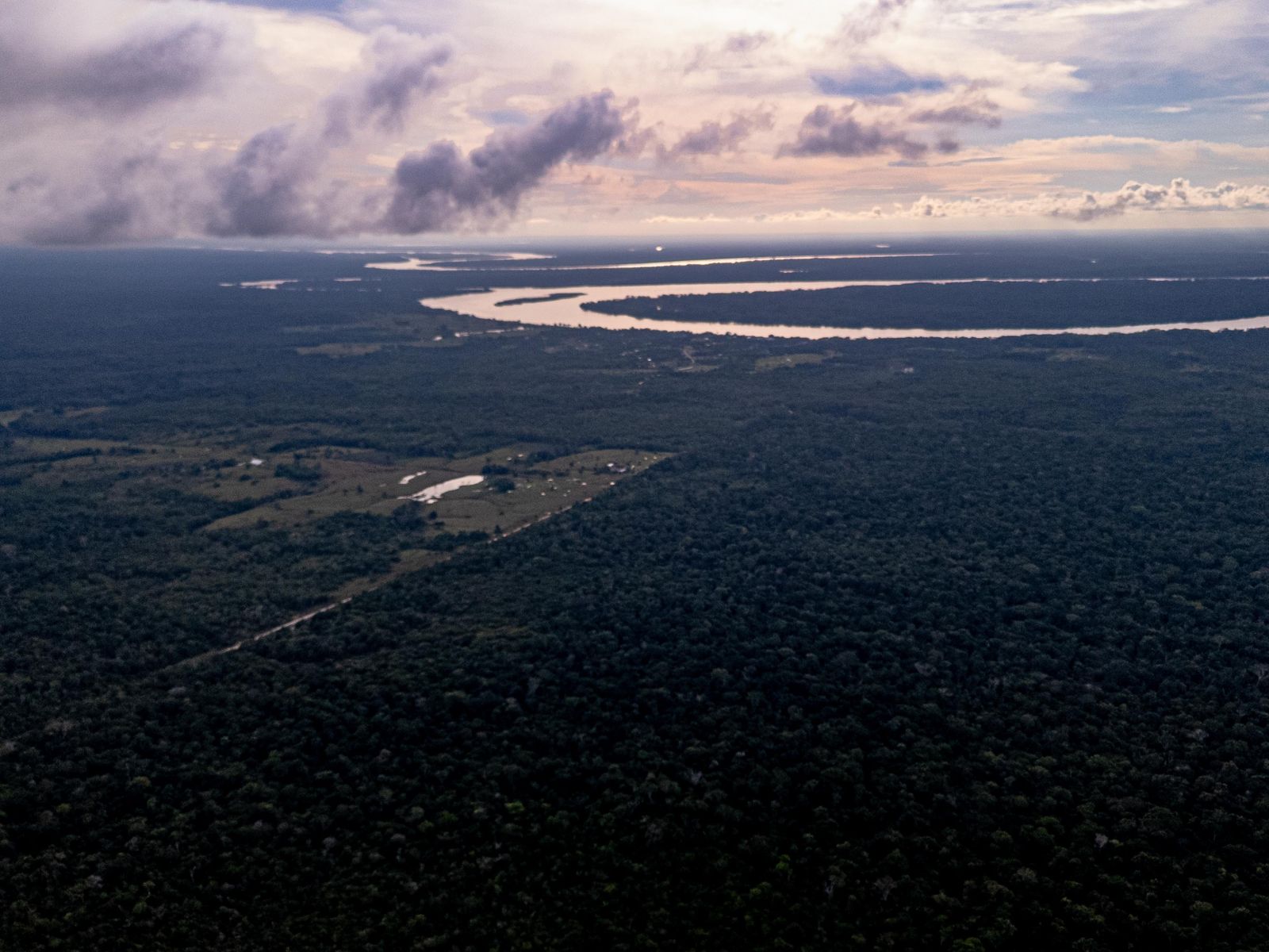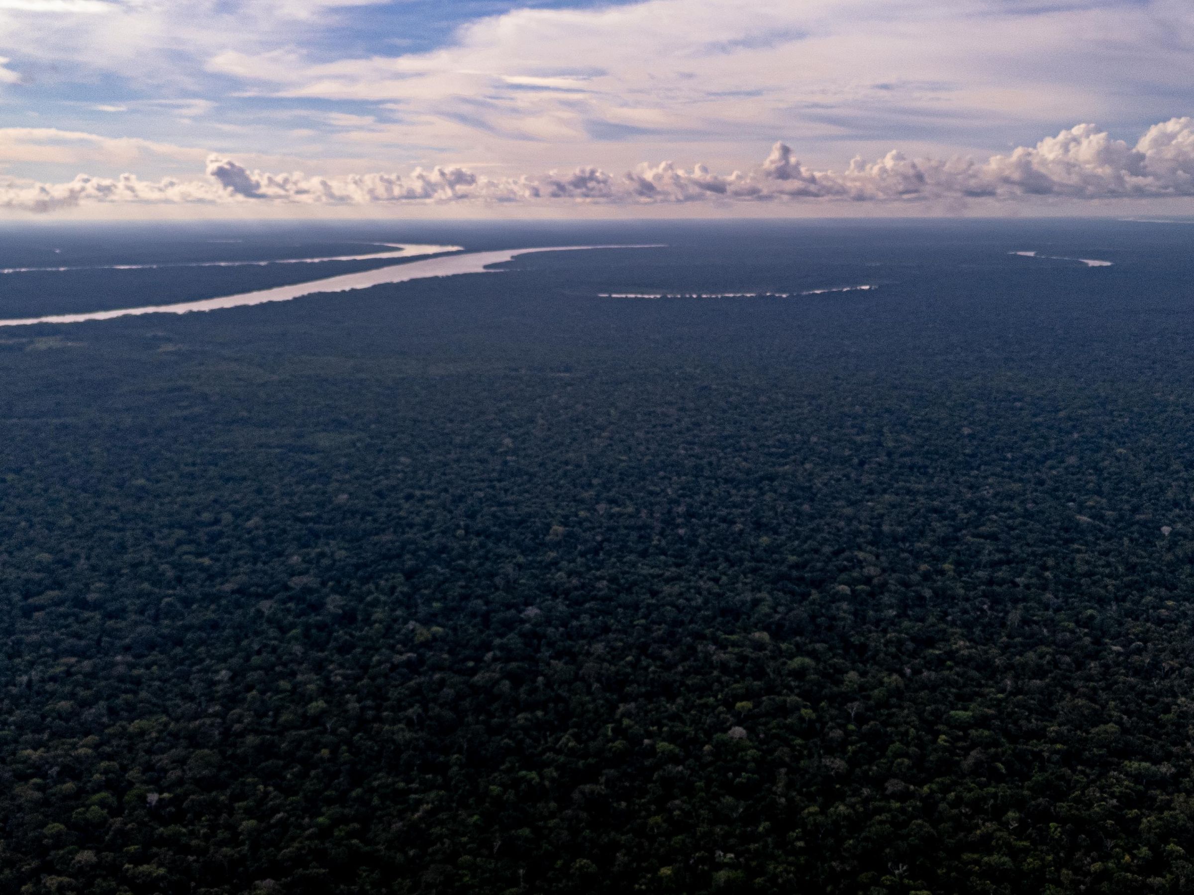
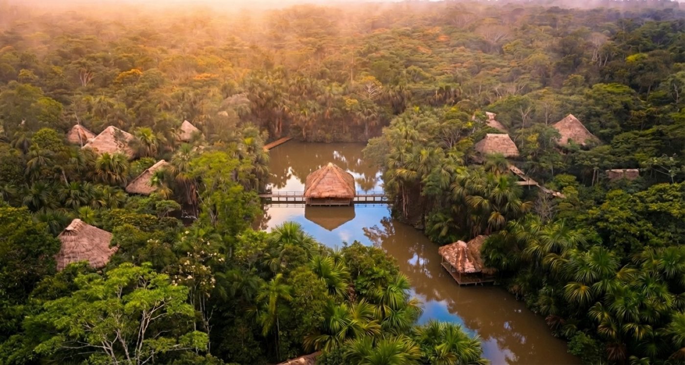
Amazon canopy from the air, Loreto; a river on the horizon

4°54′S 73°37′W · Loreto, from the air · drone survey, Feb 2026

How do we make nature worth more intact than extracted? Can nature become an economic actor rather than merely an economic resource? Can technology give nature more than a price — can it give nature agency? If nature could take part in the decisions that affect it, would we still call it a resource? What is the Amazon worth, if no one has ever counted it?

AWAKEN brings together science, technology and capital to change nature’s place in the economy. We are starting in the Amazon Rainforest.

We work on two levels. The first is status. What can be measured can be financed; what can be financed can be defended. The aim is a forest that appears on a balance sheet, not just in a mission statement.

The second is stranger. By combining sensors, AI models and a digital representation of the forest, we are building a way to ask a living system a question — and receive an answer drawn from its own data.

Until now, every debate about nature has taken place without nature. The next one may not.


01 — Thesis

Destruction pays today. A living forest pays no one.

Extraction converts forest into immediate income — timber, pasture, gold, a road. The value of a living ecosystem is dispersed, deferred and economically invisible. Markets cannot pay for what they cannot measure, so at every point of the Amazon the choice between cutting and keeping is a choice between a concrete sum today and an abstraction tomorrow.

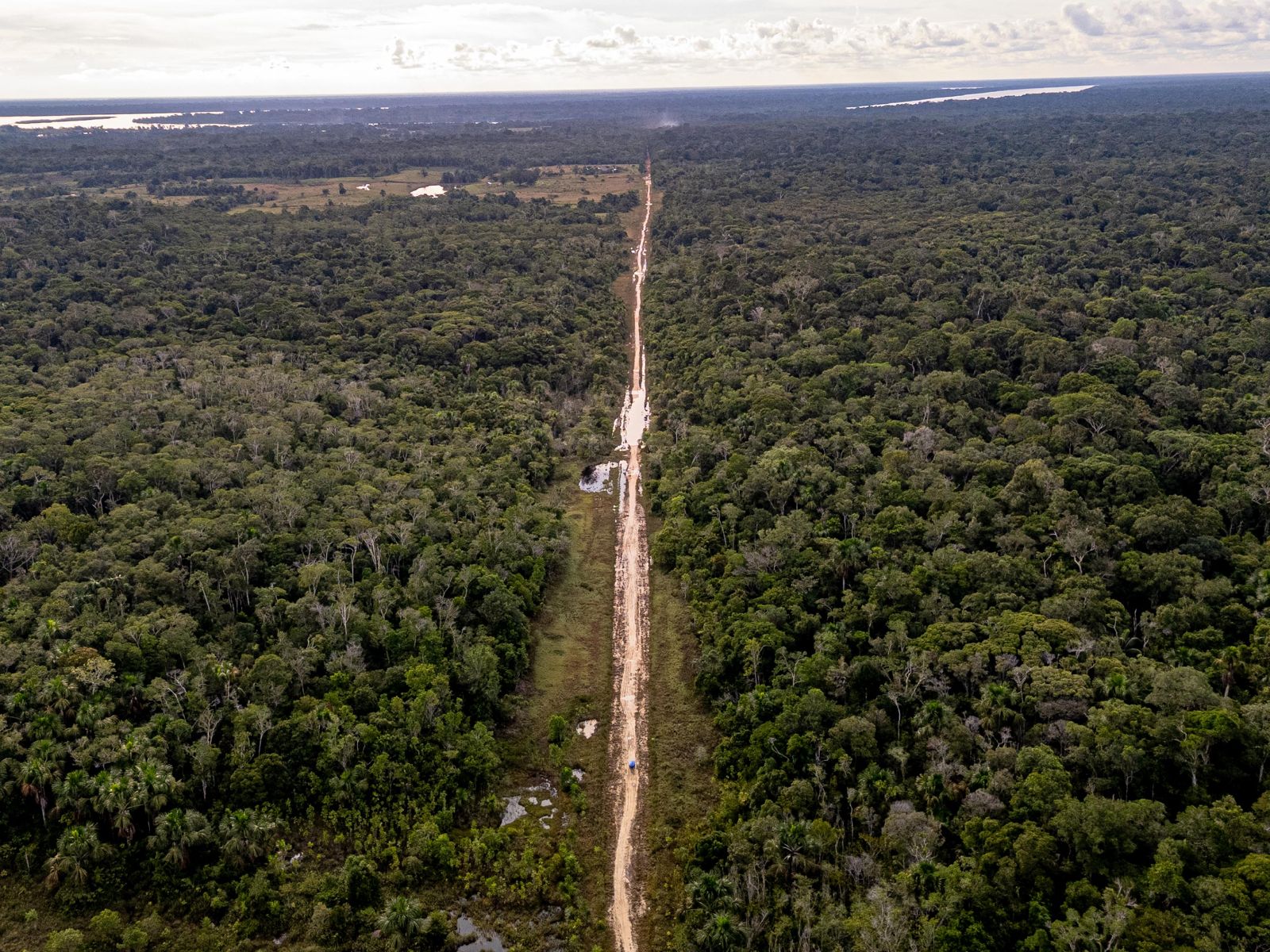
We watch it happen on our own ground: a 97-kilometre road cuts through the landscape of our concession toward the Brazilian border, and every year new clearings appear along it.

AWAKEN gives the living forest an economy of its own: territory held under a conservation regime, measured from within, proven to independent standards, financed — with the money returning to the forest and the people who keep it standing.

17–20%
of the Amazon already lost
20–25%
estimated tipping point — savanna shift, >200 Gt CO₂ released
~2 days
between newly described Amazonian species — among the least-surveyed forests on Earth
97 km
road through our concession landscape — the clearing frontier we close
Video · in preparation
Fig. 1 — The project, explained by the founder · Olga Sytnyk · video

The first site

90,179 hectares of standing forest

Where the thesis goes to work.

A conservation concession between the Pacaya-Samiria National Reserve and the Tamshiyacu-Tahuayo communal conservation area in Loreto — approved by the Regional Government of Loreto in July 2026, registration in progress. The research station, the sensor network and the first calibration of the models against a real forest will happen here.

40-year conservation concession · Loreto, Perú · granted to TERI · registration in progress


02 — Projects

Three projects, one system.

CeibaQ turns field measurement into data that can be checked. The research territory and station of the Tropical Ecosystems Research Institute are where that data is produced and the models are calibrated against a real forest. AWAKEN Sanctuary is the built base where communities, researchers and visitors meet the forest all of this protects. None of the three works alone.

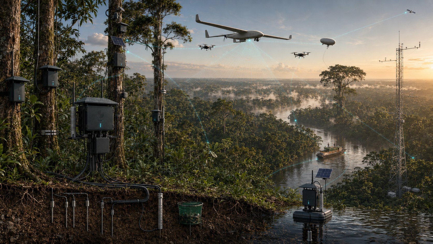
Render of the CeibaQ sensing system installed in the forest: nodes on the trees, soil probes, a hydro node, a flux tower, drones over the canopy Project 01 CeibaQ Nature data infrastructure Field measurement turned into high-integrity ecosystem data that governments, markets and scientists can check — the evidence layer beneath nature finance. We do not issue credits. 5 signal types · 1 USPTO application pending See how CeibaQ works →
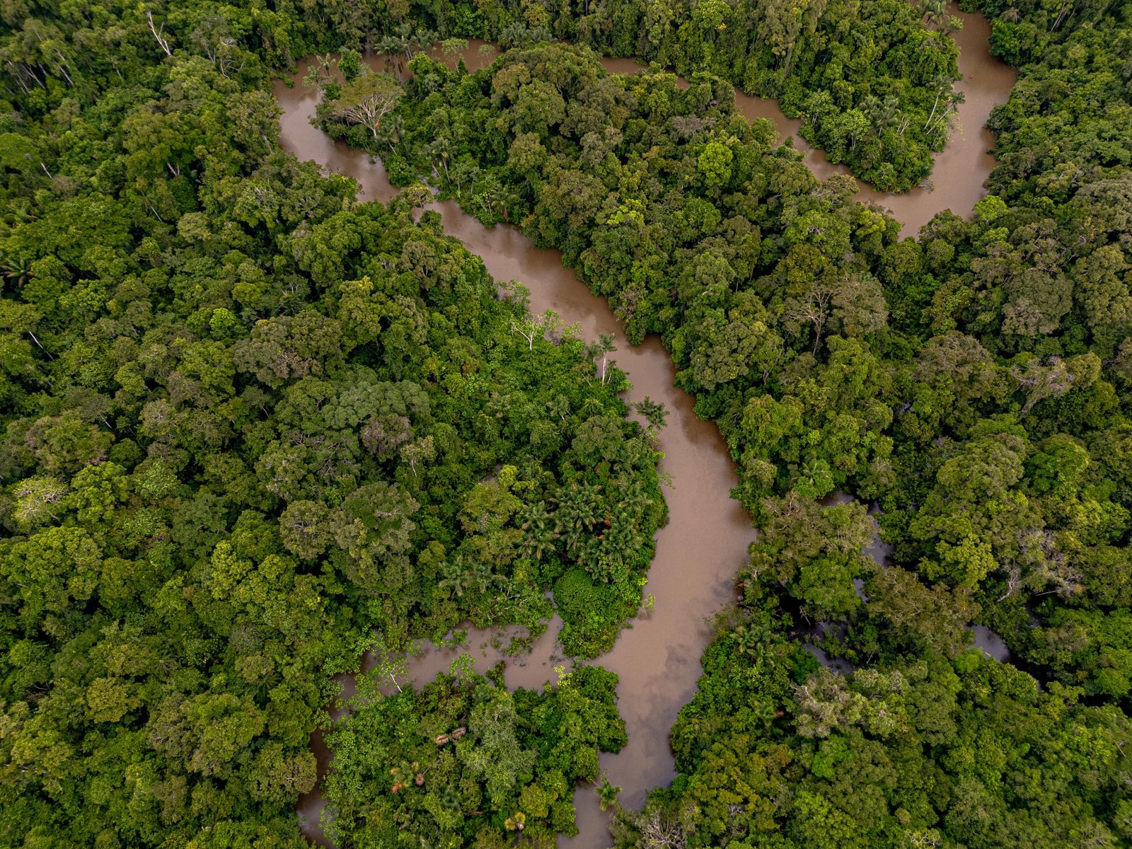
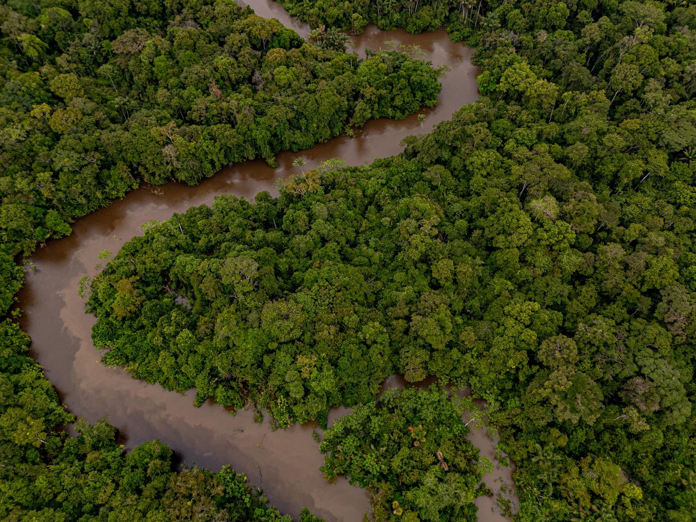
A meandering river through unbroken canopy, from the air Project 02 International Amazon Research Station Research territory and station of the Tropical Ecosystems Research Institute A 90,179-hectare conservation concession between the Pacaya-Samiria National Reserve and the Tamshiyacu-Tahuayo communal conservation area, and the field station to be built on it — where the sensor network is deployed and the models meet a real forest. 90,179 ha · 40 years · approved Jul 2026, registration in progress · 4 research directions See the territory and the station →
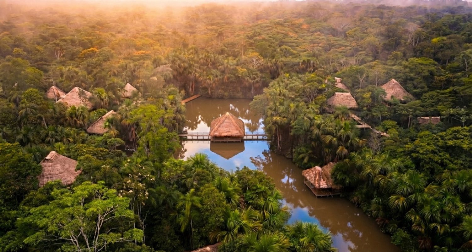
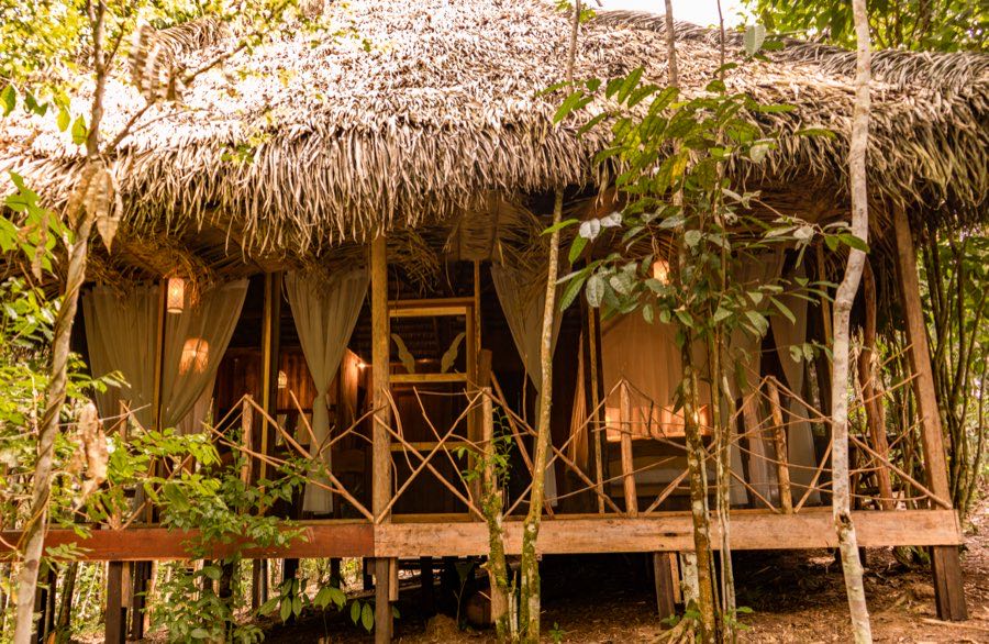
AWAKEN Sanctuary from the air: thatched villas around a lake in the forest at dawn Project 03 AWAKEN Sanctuary Nature-based hospitality A built base 15 km from Iquitos, created with four neighbouring communities and designed so that hosting people in the forest pays for protecting it, with a planned horizon of more than 52,000 hectares of protected landscape. In restart after the climate events of 2024. 24 ha · 3,782 m² built 2021–2024 See AWAKEN Sanctuary →

03 — Expansion strategy

From one concession to the basin.

Every phase runs the same loop: secure the territory, measure it from within, prove the data to independent standards, finance it, and carry the method to the next territory. Each cycle makes the next territory cheaper to protect, and the money returns to the territory and its communities.

  1. Phase 1 90,179 ha Own conservation concession, Loreto — the first site, where the station and the sensor network are built and the models are calibrated. Approved Jul 2026 · registration in progress
  2. Phase 2 420,080 ha Pilot on the Tamshiyacu-Tahuayo regional conservation area, next to the concession. GOREL–TERI memorandum · planned
  3. Phase 3 2,199,885 ha Loreto's regional conservation areas — four ACRs under the same memorandum. Expansion path · planned
  4. Phase 4 The basin Nine Amazon territories — Brazil, Peru, Colombia, Bolivia, Ecuador, Venezuela, Guyana, Suriname, French Guiana. Horizon

04 — Partners

Who we work with.

AWAKEN delegation at the MINAM stand, COP30
Fig. 2 — MINAM stand, COP30 Belém · Nov 2025
Working session at the Regional Government of Loreto
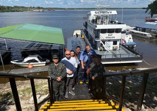
Fig. 3 — Working session, GOREL, Iquitos · Sept 2025
AWAKEN and UNAP at the eDNA library launch
Fig. 4 — eDNA library launch with UNAP · Sept 2025
Fleet study with the Peruvian Navy on the Amazon
Fig. 5 — Fleet study, Marina de Guerra · Sept 2025

Government of Peru

MINAM — Ministry of EnvironmentJoint project presentation · COP30, Belém, Nov 2025
GOREL — Regional Government of LoretoMemorandum · pilot on Tamshiyacu-Tahuayo, expansion path across the region
SERFOR — National Forest ServiceMemorandum of understanding
OSINFOR — forest-resources oversightMemorandum of understanding

Science

UNAP — National University of the Peruvian AmazonMemorandum · laboratories, field stations, joint research teams · the Amazon eDNA library
IIAP — Research Institute of the Peruvian AmazonScientific cooperation · Jenaro Herrera station

Communities & business

Four riverside communities near IquitosCooperation agreement · since 2020
CCPIP — Chamber of Commerce of Indigenous PeoplesFramework agreement · 10-year term

Ukraine · Peru

Embassy of Ukraine in PeruInstitutional support · with the Ukrainian-Peruvian Chamber of Commerce

How it started

A career in Ukraine's public institutions — a regional council, the Office of the President. Then burnout, and a decision to leave.

Fig. 1 / 11 — Before the Amazon

A ship from Barcelona to Brazil. Months in Amazon communities. Then Peru.

Fig. 2 / 11 — The way here
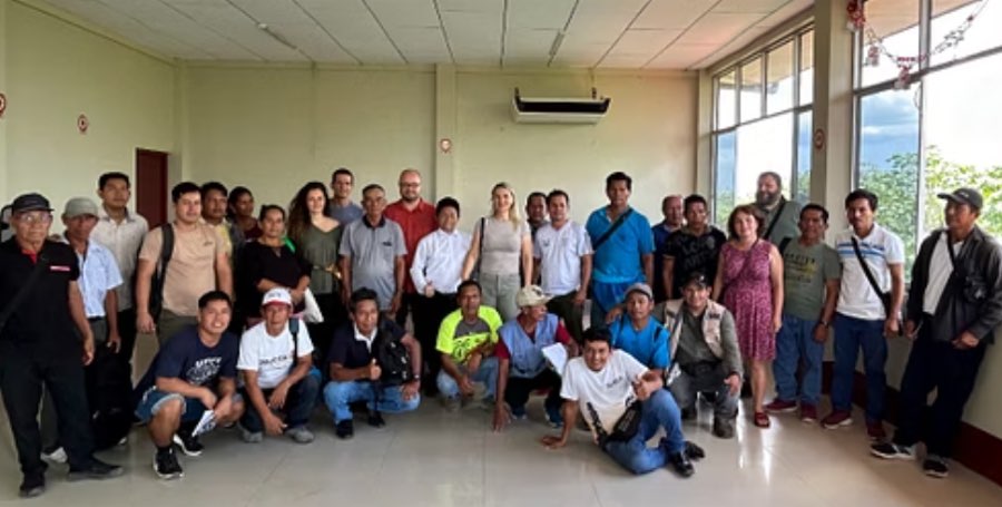
Meeting with community representatives
Fig. 3 / 11 — 2020 · A cooperation agreement with four riverside communities near Iquitos — the ground everything since has stood on.
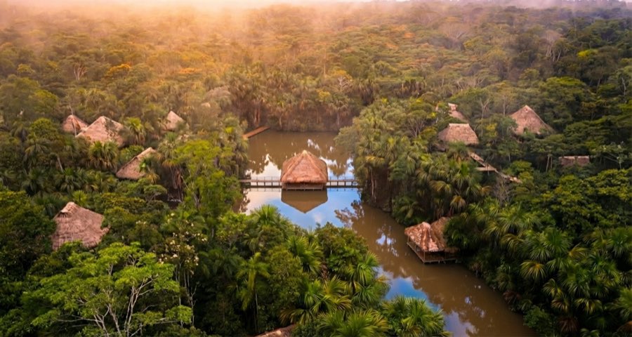
Aerial view of the AWAKEN base at dawn
Fig. 4 / 11 — 2021–2024 · A base built with the communities: 24 hectares, solar power, water treatment, Starlink, a helipad.
A villa of the base
Fig. 5 / 11 — 2023–2024 · First guests — 96+ from 15 countries. Then the 2024 climate season: a storm, a drought, wind. The base closed.
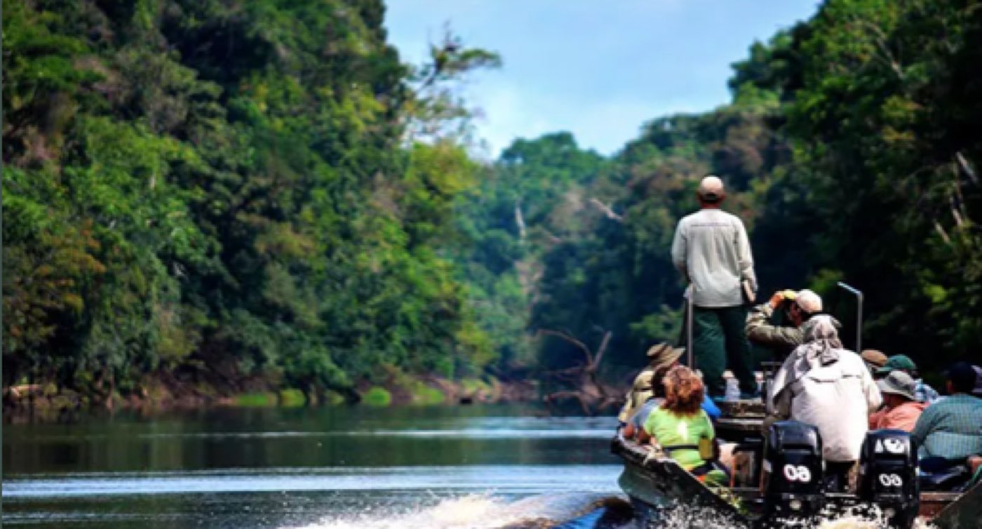
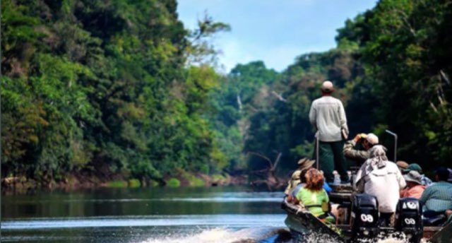
Field expedition by boat
Fig. 6 / 11 — 2024–2025 · Field expeditions on the river system with scientists from UNAP and IIAP.
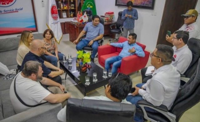
Working session at GOREL
Fig. 7 / 11 — Sept 2025 · A memorandum with the Regional Government of Loreto — a pilot on Tamshiyacu-Tahuayo, an expansion path across the region.
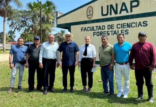
eDNA library launch with UNAP
Fig. 8 / 11 — Sept 2025 · The Amazon eDNA library launched with the National University of the Peruvian Amazon.
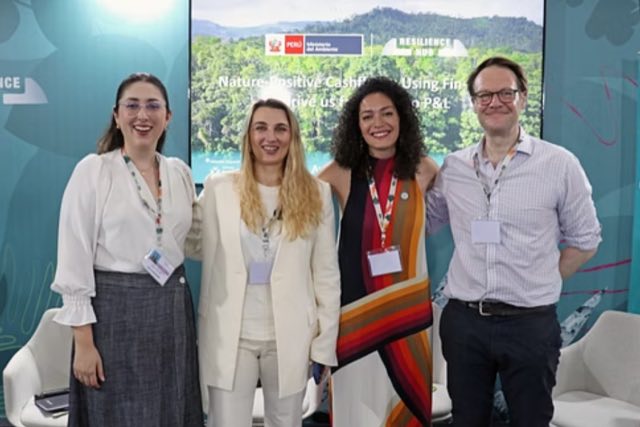
AWAKEN at the MINAM stand, COP30
Fig. 9 / 11 — Nov 2025 · Presented with Peru's Ministry of Environment at COP30, Belém.
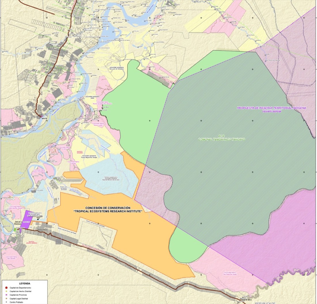
Cadastral map of the concession
Fig. 10 / 11 — Jul 2026 · A 90,179-hectare conservation concession approved by the Regional Government of Loreto — registration in progress.

Olga Sytnyk
Fig. 11 / 11 — Today · Building the infrastructure from inside the forest — not from a conference room.
05 — News & stories

Recent news

Presented with Peru's Ministry of Environment at COP30, Belém COP30 · Nov 2025
Loreto and AWAKEN: a path to co-managed conservation areas GOREL · Sept 2025
AWAKEN & UNAP launch the Amazon eDNA library UNAP · Sept 2025

Stories

Field expedition by boat on the Amazon river system Ukraine's first research base in the tropics — built to an Antarctic standard TERI · Science
Cadastral map of the conservation concession Closing the strip between two of Peru's great protected landscapes The Concession · Conservation
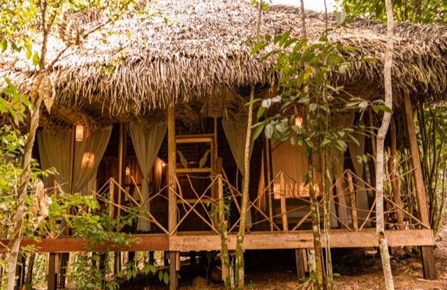
A villa of the AWAKEN base in the forest A base whose revenue pays for the forest around it AWAKEN Sanctuary · Hospitality
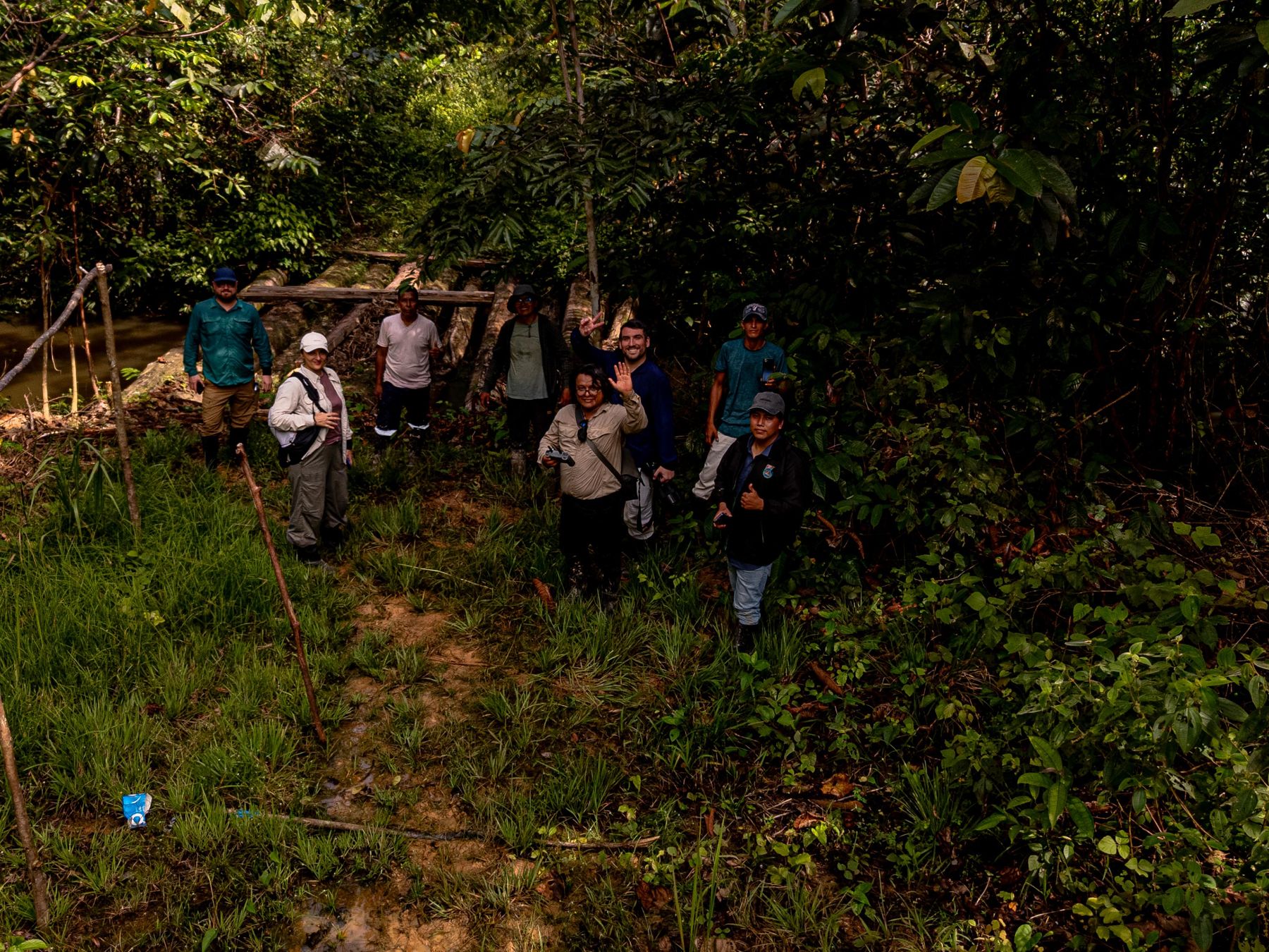
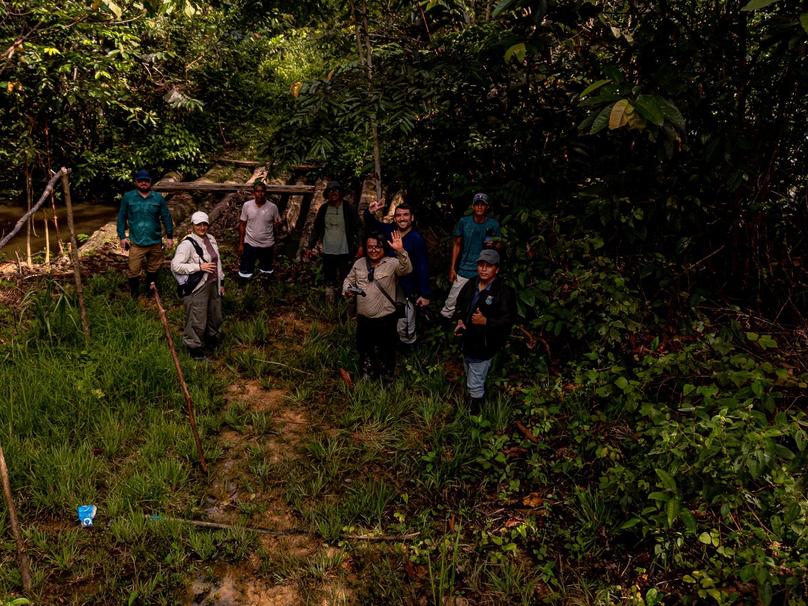
The field team at a forest camp, Loreto, seen from above
Fig. 6 — The field team at a forest camp · Loreto · Feb 2026

06 — Team

People with names — and institutions behind them.

Olga Sytnyk
Olga Sytnyk
Founder & CEO
Director of TERI · General Director, AWAKEN Management S.A.C. Based in Iquitos, Loreto.
Evgen Dykyi
Evgen Dykyi
President, TERI · Senior Scientific Advisor
Director of Ukraine's National Antarctic Scientific Center — operator of the Vernadsky station since 1996.
Fredy Francisco Ramírez Arévalo
Scientific Lead · Vice-President, TERI
Professor at the National University of the Peruvian Amazon (UNAP); forest engineer and biologist.
Galiya Kobe
Galiya Kobe
Director of Strategic Development & Partnerships
Institutional and partner relations across the AWAKEN group.
Luis Carlos Silva
Luis Carlos Silva
Chief Financial Officer
Structured finance; based in Brussels.
Olena Koval
Olena Koval
Communications Lead
17+ years in PR and journalism; led communications for national programs of Ukraine's ministries of Digital Transformation and Health.

About us

AWAKEN is a group of companies and a research institute, run by one team from Iquitos. AWAKEN Management S.A.C. is the management company of the group. AWAKEN AI S.A. builds and operates CeibaQ. AWAKEN Resort S.A.C. owns and operates AWAKEN Sanctuary. TERI, the Tropical Ecosystems Research Institute, is an independent non-profit registered in Peru in 2025: it holds the conservation concession and leads the scientific program on the research territory.

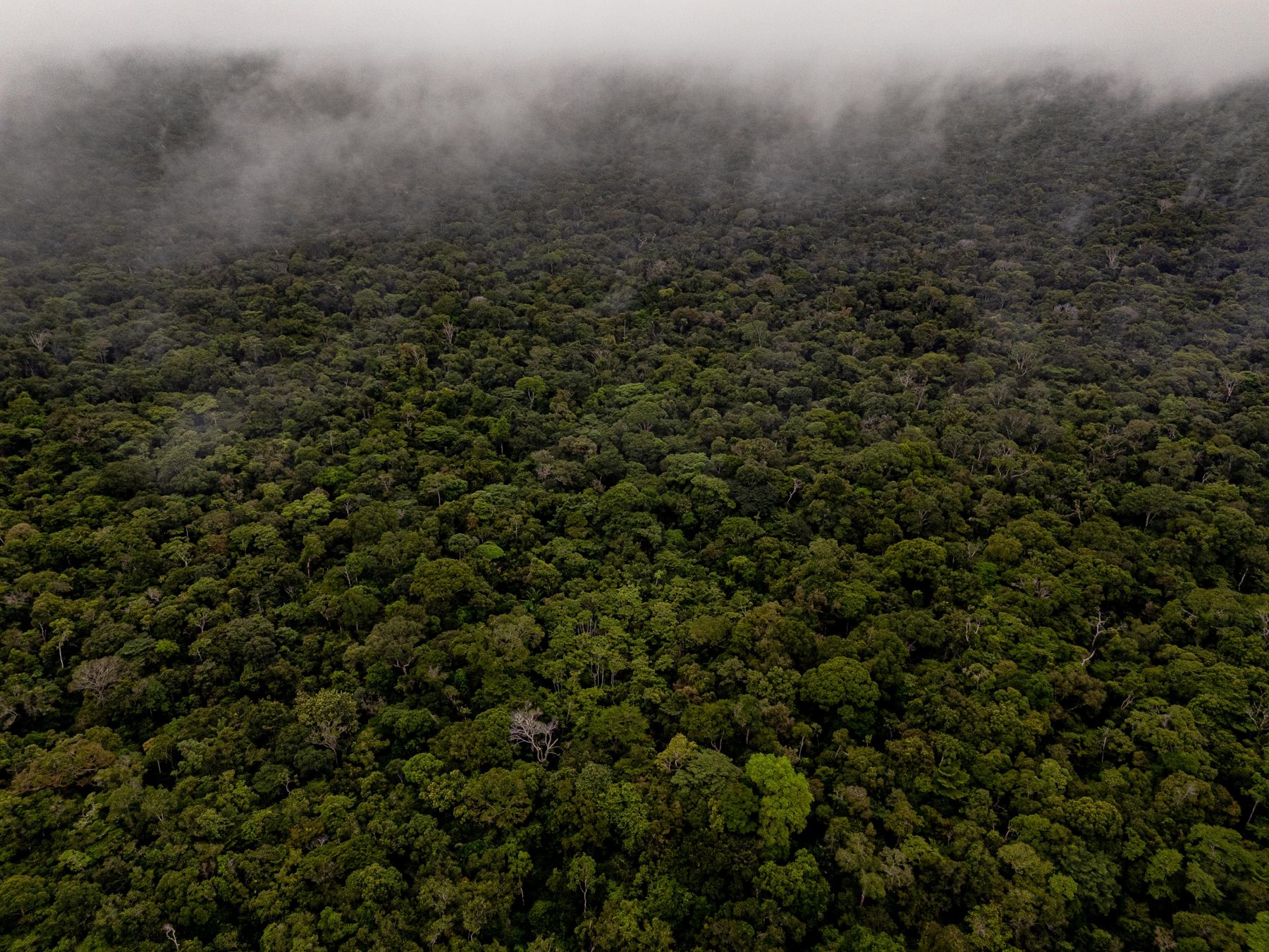
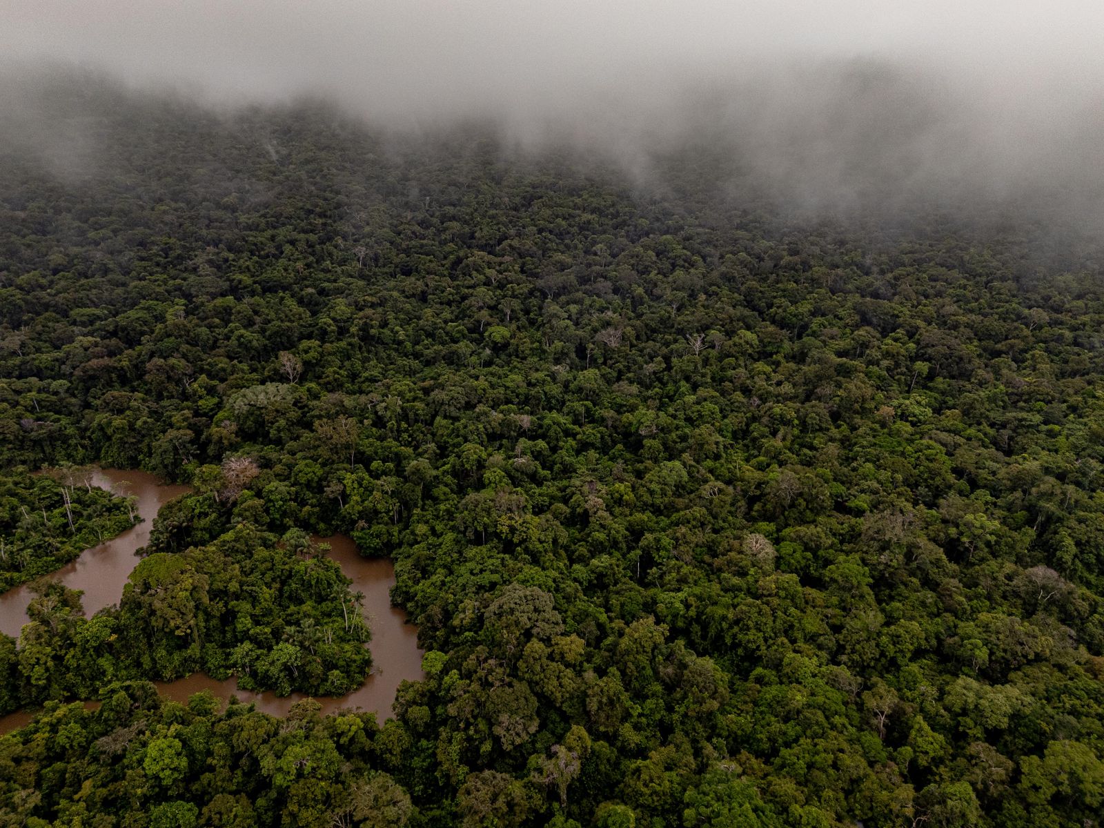
Morning fog lifting off the canopy, from the air
Fig. 7 — Morning fog over the canopy · Loreto · Feb 2026

07 — Work with us

How to work with us.

For investorsInvest in CeibaQPrivate investors and family offices: the data room holds the positioning, the technical brief and the financial model.Open the CeibaQ data room ↗
For fundersFund the conservation and research programDevelopment banks, climate funds, foundations and public research funders: the conservation program on the concession, TERI's four research directions and the research station.Request the program brief
For governments and institutionsPartner on territoriesGovernments, universities and community organisations: memoranda, pilots on protected areas, joint field programs.Write to the founder

Project 01 · Nature data infrastructure · Pre-product · Iquitos, Loreto

The Amazon Rainforest, measured from within.

CeibaQ turns direct field measurement into high-integrity, quantified ecosystem data — the evidence layer that governments, markets, insurers and scientists rely on to verify, price, account for and model nature. It is built by AWAKEN AI S.A. from Iquitos and is pre-product. We do not issue credits, and we do not define standards.

Render of the CeibaQ sensing system installed in the forest: nodes on the trees, soil probes, a hydro node on the water, a flux tower, drones and a fixed-wing aircraft scanning the canopy
Fig. 1 — The sensing system as designed, render: nodes on the trees, soil probes, a hydro node on the water, a flux tower, drone and LiDAR flights over the canopy.

01 — What it is

Measurement comes before markets.

Nature finance has run on approximation for thirty years. Carbon, biodiversity and conservation instruments priced outcomes that no one could measure at scale, because measuring a living ecosystem continuously was neither technically nor economically possible. That tolerance is ending. High-integrity standards now subtract for uncertainty, and the instruments that move real money increasingly require evidence that traces to the ground.

CeibaQ is the ground-level layer beneath those instruments. Field measurements from inside the forest are calibrated and extended across it by AI models with quantified uncertainty. The result is a queryable model of ecosystem conditions that accredited third parties can check. One dataset is designed to support carbon, biodiversity, water and resilience-related instruments: measured once, updated continuously.

We start in the Amazon because it matters most and is measured least. Around 17–20% of the forest is already gone, and science still describes a new Amazonian species roughly every two days. Satellites see the canopy. CeibaQ is built to measure what happens beneath it, and it is designed so that the host nation keeps its data rights.

5
signal types fused into one evidence layer
1
USPTO application pending · filed Jul 2025
90,179
ha — planned first calibration site, Loreto · registration in progress
2,199,885
ha — expansion path under the GOREL memorandum · planned

02 — What we are building

One evidence layer, built from five signals.

The sensing stack combines five ways of measuring a forest, each covering what the others cannot. Satellite gives spatial coverage of the whole forest. Drone LiDAR maps three-dimensional structure and plant inventory. Flux towers measure carbon, greenhouse-gas and climate exchange directly. Bioacoustics tracks wildlife and threats. Environmental DNA detects species. AI models fuse the five, calibrated across the forest, with uncertainty stated for every output.

The node network

Three tiers, as designed. ECHO nodes record sound, microclimate and soil conditions; Nexus hubs add cameras and dendrometers; reference stations measure over 1,500 parameters. One-hectare permanent plots are measured twice, by classical forestry and by laser, as the standard everything else is checked against. The first network is planned for the 90,179-ha research territory in Loreto.

Models with quantified uncertainty

Field measurements are calibrated and extended across the forest by proprietary AI models. Every output is designed to carry a confidence interval, its provenance and the methodology version, so that an accredited third party can trace it back to the ground. The model is continuously updated and queryable on demand.

One dataset, many uses

One dataset supports carbon, biodiversity, water and resilience-related instruments: jurisdictional verification, environmental finance, ecosystem accounting, MRV-aligned data for credits under accredited standards, scientific research, and a calibration and benchmark layer for environmental AI. Outputs are designed to be delivered in the native format of the framework that uses them.

Sovereign by design

CeibaQ is designed for integration with national forest-monitoring systems, with Free, Prior and Informed Consent from local and Indigenous communities, compliance with the Nagoya Protocol where applicable, and benefit-sharing by design. The host nation's forest; the host nation's data rights.

Satellitespatial coverage of the whole forest Drone LiDAR3D structure mapping · plant inventory Flux towersdirect carbon, greenhouse-gas & climate measurement Bioacousticswildlife & threat monitoring eDNAspecies & biodiversity detection AI models calibrated across the forest, with quantified uncertainty The evidence layer independently verifiable · queryable on demand
Fig. 2 — The CeibaQ sensing stack: five signals fused by AI models into one evidence layer.

Scroll → to see the full diagram

The line we never cross

We do not issue credits. We do not define standards. We supply the evidence layer they rely on.

A data supplier cannot certify its own data. CeibaQ is built to produce data that accredited third parties can check — quantified, with provenance, independently verifiable.


03 — Where we are now

Where we are now.

CeibaQ is pre-product. The specifications describe design and intended coverage, not delivered scale. The memoranda and the eDNA library are in place; the concession that will serve as the first calibration site is approved and awaiting registration. The first field deployment is the next step. No client names are cited until contractual.

WhenWhatStatus
Jul 2025USPTO nonprovisional patent application filed — one application, pendingDONE
Sept 2025Amazon eDNA library launched with the National University of the Peruvian Amazon (UNAP)DONE
Sept 2025Memorandum with the Regional Government of Loreto — pilot on Tamshiyacu-Tahuayo, expansion path 2,199,885 haDONE
Nov 2025Joint project presentation with MINAM at COP30, BelémDONE
Jun 2026Investor data room opened — positioning, technical brief, financial modelDONE
6 Jul 202690,179-ha conservation concession approved by GOREL — the planned first calibration site; registration in progressIN PROGRESS
NextFirst deployment of the node network on the research territoryPLANNED
ThenPilot on the Tamshiyacu-Tahuayo regional conservation area, 420,080 ha, under the GOREL memorandumPLANNED

04 — What we need

What we need from partners.

Partnership here means three things: capital to build the first deployment, territories on which the data has an owner and a use, and scientists who help calibrate the models against a real forest. Each has its own door.

InvestorsBack the first deploymentPrivate investors and family offices: the data room holds the positioning, the technical brief and the financial model. CeibaQ is pre-product and is raising capital to build and calibrate the first node network on the research territory in Loreto.Open the investor data room ↗
Governments, jurisdictions and project developersRun a pilot on your territoryWe are looking for pilot partners with a defined territory and a use for the data: jurisdictional verification, ecosystem accounting, or MRV-aligned data for an instrument under an accredited standard. The memorandum with the Regional Government of Loreto is the model for such a pilot.Propose a pilot
Scientific partnersCalibrate the models with usResearch institutes and laboratories working on forest measurement, eDNA reference libraries, bioacoustics or flux measurement: joint field teams, shared reference plots and the calibration of models against ground data. The National University of the Peruvian Amazon and IIAP are partners on record.Write about calibration

05 — Further reading

Siteceibaq.com ↗Product site — positioning, how it works, sovereign by design
Data roomCeibaQ investor data room ↗Positioning, technical brief and financial model

1 — CeibaQ is pre-product: specifications describe design and intended coverage, not delivered scale. No client names are cited until contractual. One USPTO application is pending; nothing is patented.

2 — Designed for compatibility with TFFF, LEAF, CORSIA, Article 6.2, SEEA-EA, Verra and ART-TREES — compatibility, not endorsement.

3 — The 90,179-ha conservation concession, applied for by AWAKEN Management S.A.C. and TERI, was approved by the Regional Government of Loreto on 6 Jul 2026; registration is in progress. CeibaQ does not hold it. The 2,199,885-ha expansion path under the GOREL memorandum is planned, not contracted.

Project 02 · Research territory and station · Approved Jul 2026, registration in progress · Loreto

The ground the whole system will be calibrated against.

A 90,179-hectare, 40-year conservation concession in Loreto, under a regime that excludes industrial logging, and the field research station planned on it. This is where the sensor network is to be deployed and the models calibrated against a real forest — the ground truth the whole AWAKEN system depends on. Approved by the Regional Government of Loreto in July 2026; registration in progress.

Fig. 1 — Official project map of the conservation concession application — TERI and AWAKEN Management S.A.C., 90,179 ha, one continuous block between Pacaya-Samiria and Tamshiyacu-Tahuayo. Source: application file, GOREL, 2026. Click to enlarge the full sheet.

01 — What it is

Where the models meet a real forest.

The territory lies in northeastern Peru, in the provinces of Requena and Mariscal Ramón Castilla, near the confluence of the Marañón and the Ucayali, where the Amazon river begins. It fills the strip between the Pacaya-Samiria National Reserve and the Tamshiyacu-Tahuayo communal conservation area, to which it directly adjoins. Together they form a managed landscape of roughly 510,000 hectares. To the east the block reaches the Yavarí basin, along which the border with Brazil runs.

Every measurement CeibaQ produces has to be checked against a forest someone can walk into. This is that forest. Two applicants filed for it as one continuous block: AWAKEN Management S.A.C. with 43,343 hectares and TERI with 46,835. The 40-year conservation regime excludes industrial logging. On this ground the sensor network is to be built, the one-hectare reference plots measured, and the models calibrated before they are carried to any other territory.

The scientific program is led by the Tropical Ecosystems Research Institute (TERI), an independent non-profit registered in Peru on 22 October 2025. Its president, Evgen Dykyi, directs Ukraine's National Antarctic Scientific Center, which has kept the Akademik Vernadsky station running since 1996. Its vice-president, Fredy Francisco Ramírez Arévalo, is a professor at the National University of the Peruvian Amazon (UNAP). The Amazon station is to be run to the same standard: a permanent base in a remote place.

90,179 ha
one continuous block · 40-year conservation concession
~510,000 ha
managed landscape with Pacaya-Samiria and Tamshiyacu-Tahuayo
102
reptile and amphibian species — the record count for Loreto
97 km
road through the landscape · the frontier the concession is designed to close

The territory · drone survey, Feb 2026

Unbroken canopy to the horizon, the river beyond, in daylight
Fig. 1 / 8 — Feb 2026 · The territory from the air: unbroken canopy to the horizon, the river beyond.
A river winding through closed canopy
Fig. 2 / 8 — Feb 2026 · A river winds through the interior. The water ecosystems of the basin are one of the four research directions.
A straight dirt road with vehicles cutting through the forest toward the horizon
Fig. 3 / 8 — Feb 2026 · The road toward the Brazilian border, along the edge of the block — the clearing frontier the concession is designed to close.
Morning fog lifting off the canopy above a river
Fig. 4 / 8 — Feb 2026 · Morning fog over the canopy.
A river meander under an evening sky
Fig. 5 / 8 — Feb 2026 · Evening over the meander.
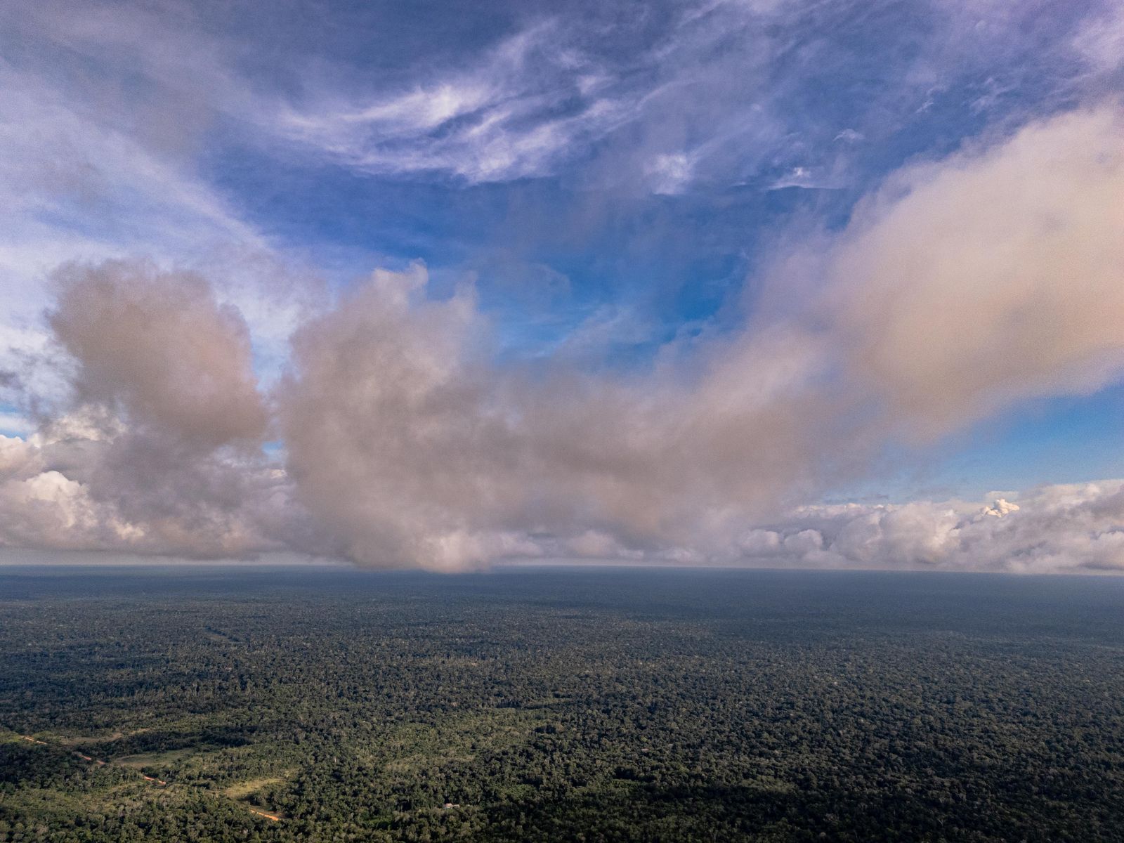
Rain clouds moving over the forest
Fig. 6 / 8 — Feb 2026 · Weather moving in over the forest.
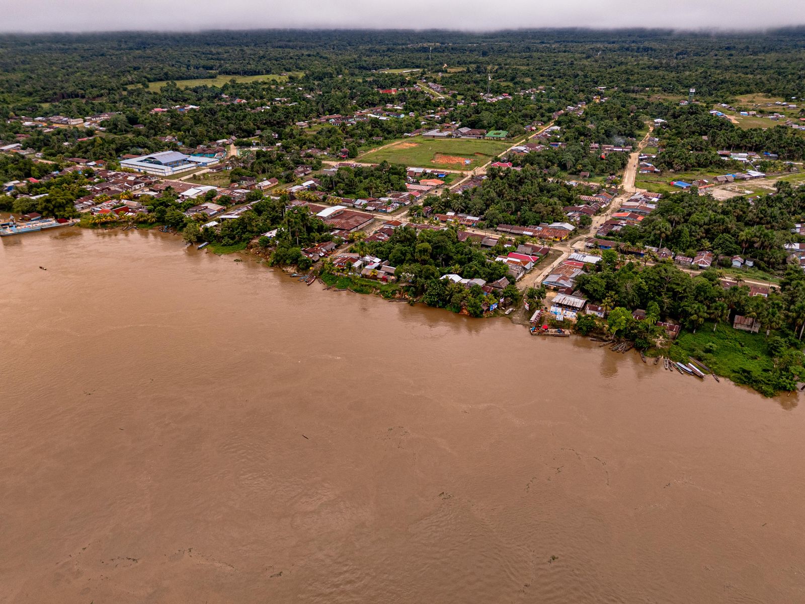
A riverside community on a wide brown river, forest behind it
Fig. 7 / 8 — Feb 2026 · A riverside community near the territory. Free, prior and informed consent and benefit-sharing are part of the design.
The field team at a forest camp
Fig. 8 / 8 — Feb 2026 · The field team at a forest camp during the survey.

02 — What we are building

The station, four research directions and the path beyond.

The International Amazon Research Station is planned as a permanent field base on the concession, to be run by TERI with Peruvian partners: the laboratories and field stations of UNAP under its memorandum, the Jenaro Herrera station of IIAP, and joint Ukrainian-Peruvian research teams. Its design and funding are in preparation. The research program has four directions. Each is designed to produce data CeibaQ can use, and each depends on the territory staying protected for the full 40 years.

The interfluve is documented in the concession application file: around 1,650 plant species; around 150 mammal species, including 13 primates, among them the vulnerable red uakari; around 320 bird species; and 102 reptile and amphibian species, the record count for Loreto. Jaguar, giant otter, Amazonian tapir, giant armadillo, giant anteater, anaconda and black caiman are confirmed present. The 97-kilometre Jenaro Herrera – Colonia Angamos road cuts through this landscape toward the Brazilian border. Every year new clearings appear along it, and the strip of unprotected forest between the clearings and the protected areas grows narrower. The concession application covers that strip.

1 · Forest-measurement technology

A proving ground for new instruments. The design: a three-tier ground network of acoustic, microclimate and soil nodes, camera-and-dendrometer hubs and reference stations measuring over 1,500 parameters, plus drone LiDAR, terrestrial laser scanning and satellite analysis. One-hectare permanent plots are to be measured twice, by classical forestry and by laser, as the standard everything else is checked against.

2 · Biodiversity and genetic libraries

Species inventories of the territory, plus the DNA barcodes and training-image sets that most Amazonian species still lack. Without them no AI model can work with living nature. The work builds on IIAP's laboratory and UNAP's database of Amazonian plants, and continues the Amazon eDNA library launched with UNAP in September 2025.

3 · Water ecosystems of the basin

River and floodplain surveys following the Joint Danube Survey methodology, Europe's largest river-research program, whose Ukrainian component was led by TERI's secretary. A network of sampling stations; eDNA, where one water sample reveals hundreds of species upstream without catching an animal; chemistry, microplastics and antibiotic resistance.

4 · A digital twin of the forest

All streams are to converge into one 3D model of the territory: structure, biomass, hydrology, living cover. It is designed to be updated by a continuous flow of measurements, not by single snapshots, and to serve as the reference every later change is checked against. No comparable protected area of the Peruvian Amazon has one. Protocols are designed for open publication and annual natural-capital reporting.

5 · The expansion path

The method is built to travel. The memorandum with the Regional Government of Loreto names Tamshiyacu-Tahuayo, 420,080 hectares next to the concession, as the pilot, and provides for expansion, if the pilot succeeds, across four regional conservation areas totalling 2,199,885 hectares. Beyond Loreto lie the other countries and territories of the Amazon basin. All of this is planned; the concession is the first step.

What the concession changes

Once registered, it closes the strip — and puts a station, a sensor network and a 40-year regime inside it.

The 97-km Jenaro Herrera – Colonia Angamos road opened the forest's interior. The concession stands between the clearings and the protected areas.


03 — Where we are now

Where we are now.

The concession is approved, not yet registered. The institute exists and has its partners. The station does not yet exist: its design and funding are in preparation, and the research program starts on the ground once the registration is complete and the first funding is in place.

WhenWhatStatus
Sept 2025Memorandum with the Regional Government of Loreto: pilot on Tamshiyacu-Tahuayo, expansion path of 2,199,885 haDONE
Sept 2025Amazon eDNA library launched with the National University of the Peruvian Amazon (UNAP)DONE
22 Oct 2025TERI registered in Peru as an independent non-profit (RUC 20615536386)DONE
Feb 2026Drone survey of the territoryDONE
23 Mar 2026Concession application filed by AWAKEN Management S.A.C. (43,343 ha) and TERI (46,835 ha)DONE
6 Jul 2026Application approved by the Regional Government of Loreto (GOREL)DONE
2026Registration of the concessionIN PROGRESS
NextInternational Amazon Research Station: design and funding in preparationPLANNED

04 — What we need

What we need from partners.

The concession is approved and the research program has its four directions. What turns a territory into a research station is money for the building and the field program, scientists who bring their own questions and instruments, and institutions that stay with the territory for 40 years.

FundersFund the station and the research programDevelopment banks, climate funds, foundations and public research funders: the station building, the sensor network and the four research directions on the concession. Formats include funding one component, named research fellowships, equipment, naming a laboratory or module of the station, and institutional partnership.Request the program brief
Scientific partnersBring a research group to the territoryUniversities and institutes: joint field programs on the four directions, shared protocols and permanent plots, exchange of researchers and students, and co-authored publications. Laboratories and field stations are available through the memorandum with UNAP and the cooperation with IIAP; the territory offers a 40-year horizon for long-term series.Propose a joint program
Governments and communitiesKeep the territory protected with usThe Regional Government of Loreto, SERFOR and the communities of the territory: the management plan and boundary marking, community guard brigades and patrols, and the pilot on Tamshiyacu-Tahuayo under the GOREL memorandum. Free, prior and informed consent and benefit-sharing are part of the design.Write to the founder

05 — Further reading

DocumentPresentation for the Regional Government of LoretoPDF, to be added
PageContact →olga@awkn.ai

1 — The concession application was filed on 23 March 2026 and approved by the Regional Government of Loreto on 6 July 2026; registration is in progress. Until it is complete, the concession is approved, not registered.

2 — The International Amazon Research Station is planned. Its design and funding are in preparation; no building exists on the territory today.

3 — Species counts are taken from the concession application file (GOREL, 2026), compiled from published surveys of the Yavarí–Ucayali interfluve. The pilot on Tamshiyacu-Tahuayo and the 2,199,885-hectare expansion path are planned under the GOREL memorandum, not started.

Project 03 · Nature-based hospitality · In restart · Santa Clara de Ojeal, Loreto

Presence that funds protection.

A built base on the Amazon river system, 15 km from Iquitos, designed so that hosting people in the forest pays for protecting it. Twenty-four titled hectares, 3,782 m² built between 2021 and 2024 with four neighbouring communities under a cooperation agreement running since 2020. Closed after the climate events of 2024. In restart.

Aerial photograph of the AWAKEN Sanctuary base at dawn: villas around the lake, forest on every side
Fig. 1 — The base at dawn: 24 ha, 3,782 m² built 2021–2024. Santa Clara de Ojeal, Loreto.

01 — What it is

Hosting people in the forest pays for protecting it.

At the edge of the forest the arithmetic is simple: a cleared plot pays today, a standing one pays no one. AWAKEN Sanctuary was built to change that arithmetic on one piece of ground. People come to the forest — small groups, retreats, expeditions, research stays. What they pay is meant to fund the protection of the territory and the science conducted on it.

The base stands on 24 hectares at Santa Clara de Ojeal, on the river system 15 km from Iquitos. The land was bought directly from the families who held it and titled with SUNARP. It was built between 2021 and 2024 with the four neighbouring communities — Santa Clara zones 1, 2 and 3 and Barrio Florido, more than 1,500 people — under a cooperation agreement in place since 2020.

It is also the base of the wider AWAKEN system: the place where communities, researchers and visitors meet the forest. Ecological baseline studies with UNAP and IIAP are the foundation for the planned private conservation area. Between December 2023 and 2024 the base hosted more than 96 guests from 15 countries. Then the climate events of 2024 forced it to close.

24 ha
SUNARP-titled · 3,782 m² built 2021–2024
96+
guests from 15 countries · Dec 2023 – 2024
4
communities · 1,500+ people · agreement since 2020
45
permanent jobs at operation · 400+ temporary during construction

02 — What we are building

Built so the money stays on the ground.

The base is designed so that money earned in the forest does not leave it. Guests pay for presence; that revenue is meant to become employment for the communities, benefit-sharing under the 2020 agreement, and the field science conducted on the territory. The physical base exists. The protected landscape it is meant to fund is the next step, and it is planned, not done.

AWAKEN Sanctuary is operated by AWAKEN Resort S.A.C., domiciled in Loreto.

The mechanism

Small groups, retreats, expeditions and research stays pay for time in the forest. The revenue is designed to fund three things on the ground: employment for the four neighbouring communities, benefit-sharing and participation under the cooperation agreement in place since 2020, and the ecological studies conducted on the territory with UNAP and IIAP.

The infrastructure

Solar power with backup generation. Water treatment and filtration with 2.5 hectares of reservoirs. Starlink connectivity. A 220 m² restaurant, a 180 m² yoga hall, a 200 m² gathering hall, staff housing, a tree platform and a private helipad, inside a guarded perimeter with three security gates. Materials sourced locally; built with the communities.

The planned protected landscape

From 24 hectares toward a protected landscape of more than 52,000: roughly 2,000 hectares of community land as a private conservation area (ACP), and a ~50,000-hectare SERFOR ecotourism concession on adjacent public forest as an ecological corridor. Both are planned. Neither has been applied for or designated yet.

Science on site

Ecological baseline studies with UNAP and IIAP form the foundation for the planned ACP designation and for biodiversity monitoring on the territory. Student research was hosted during the closure. UNAP works with AWAKEN under a memorandum; IIAP under scientific cooperation.

The legal and fiscal base

All land is private property registered with SUNARP, with a formalised chain of title. AWAKEN Resort S.A.C. holds a tourism licence. Under Ley 27037, operations domiciled in Loreto carry a reduced income-tax regime in force through 2048, subject to the entity's qualification under the law.

The mechanism

Revenue stays on the ground.

Employment, benefit-sharing and science, with the communities of Santa Clara and Barrio Florido.


03 — Where we are now

Where we are now.

The base is built and titled, and demand was tested with real guests. It is not operating. The climate events of 2024 — a storm in February, drought from July to September, wind from September to November — damaged the electrical system, the roofs of 12 villas, the yoga hall and two of three water pumps. Repairs began in 2026. The restart data room is open.

WhenWhatStatus
2020Cooperation agreement with the four neighbouring communities: Santa Clara zones 1–3 and Barrio FloridoDONE
2021–2024Base built: 24 ha titled with SUNARP, 3,782 m² — solar, water treatment, Starlink, restaurant, halls, helipadDONE
Dec 2023 – 2024First operating season: 96+ guests from 15 countries, including a 20-person retreatDONE
Feb – Nov 2024Storm, drought and wind damage the electrical system, 12 villa roofs, the yoga hall and two of three pumps; the base closesDONE
2026Restart data room open to investors and partnersDONE
2026Repairs: roofs, yoga hall, pumps, climate-resilient water and electrical systemsIN PROGRESS
After repairsReopening of operations with the communities and operator partnersPLANNED
After reopeningPrivate conservation area on ~2,000 ha of community land and ~50,000 ha SERFOR ecotourism concession — the 52,000+ ha horizonPLANNED

04 — What we need

What we need from partners.

The restart is a defined piece of work: repair what the 2024 season damaged, reopen, and reach the point where the base pays for the conservation around it. Partnership here means capital for the restart, operators who bring programs and groups, and funders for the community and conservation program.

Investors and partners for the restartFund the restartInvestors and strategic partners who want a built, titled asset in the Peruvian Amazon with a real guest record and a defined repair plan. The data room holds the restart plan, the financial model and the terms of the raise. Forward-looking figures there are management estimates.Open the Sanctuary data room ↗
Hospitality and retreat operatorsBring a program to the forestRetreat, expedition and wellness operators who build programs for small groups. AWAKEN Sanctuary provides the territory, the villas, the staff and the logistics from Iquitos; the operator brings the program and the guests. Conversations for the first season after reopening are open now.Write about an operator partnership
Community and conservation program fundersFund the community and conservation programFoundations, conservation funds and development programs interested in the planned private conservation area on community land, the planned ecotourism concession as an ecological corridor, and the employment and benefit-sharing program with the four communities around the base.Request the program brief

05 — Further reading

Data roomAWAKEN Sanctuary data room ↗Teaser, restart plan, financial model and terms of the raise — for investors and partners
PageThe system: CeibaQ, the research territory and the base →How the three projects work together
PageContact the founder →olga@awkn.ai — Iquitos, Loreto

1 — The 52,000+ ha protected landscape is the planned horizon of this mechanism (ACP designation and SERFOR ecotourism concession). Neither has been applied for or designated. It is distinct from the 90,179-ha conservation concession described on the research territory page.

2 — The base has been closed since the climate events of 2024. Guest figures refer to the December 2023 – 2024 operating season. The timing of reopening depends on the completion of repairs and the restart capital.

3 — Ley 27037 provides a reduced income-tax regime for operations domiciled in Loreto, in force through 2048; its application is subject to the entity's qualification under the law. Memoranda with UNAP and IIAP are cooperation instruments, not endorsements.

05 — News & record

A public record of the work.

Institutional agreements, field programs and public presentations — dated as they happened.

Nov 2025Presented with Peru's Ministry of Environment at COP30, BelémJoint project presentation with MINAM at the Peru pavilion, UN Climate Change Conference COP30.
Sept 2025Loreto and AWAKEN: a path to co-managed conservation areasMemorandum with the Regional Government of Loreto — pilot on Tamshiyacu-Tahuayo, expansion path across the region's conservation areas under the project "AWAKEN Inteligencia del Bosque".
Sept 2025AWAKEN & UNAP launch the Amazon eDNA libraryBuilding the genetic reference libraries most Amazonian species still lack — with the National University of the Peruvian Amazon.
Sept 2025Fleet study with the Peruvian Navy on the AmazonAssessing river logistics for the monitoring program on the Amazon's main waterways.
July 2025Ten-year framework with the Chamber of Commerce of Indigenous PeoplesA long-term framework agreement — cooperation with Indigenous organisations on monitoring and benefit-sharing.
Since 2020Four communities, one cooperation agreement1,500+ neighbours around the base: employment, participation and benefit-sharing, formalised since 2020.

Documentation for each entry — memoranda, photographs, approval files — is available in the dossier on request.